About
North Iceland offers a multitude of opportunities for those who want adventurous activities in a true natural paradise. The waterfalls of Goðafoss and Dettifoss, the latter Europe’s mightiest are highlights in the region. Downstream from Dettifoss, explore Jokulsargljufur, one of the country’s most awe-inspiring canyons. Here can be found the Hljodaklettar formations and Ásbyrgi canyon, where the waters of the Jokulsa river have shaped stark cliffs. The Myvatn volcanic zone and its entire environs are world-famous for their beauty, the cliffs of Dimmuborgir comprise a wondrous world of their own, this is the where the Yule Lads live, don’t miss them if you are passing around.
Hostels
Akureyri Backpackers and Kópasker Hostel are two hostels I would recommend. Their locations are perfect to break up the journey across the north of the country. There are 3 or 4 other hostels located in north as well, head to hostel.is to find them.
Sights and Highlights
Vopnafjörður
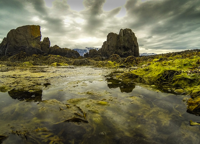
Waterfalls, picturesque mountains, historical sites and killer whales swimming in the bay, Vopnafjörður’s attractions are almost endless. Volcanoes, glacial rivers and black mountain deserts can all be found within a short drive. The village of Vopnafjörður lies on a spit jutting out from the fjord, forming Nípsfjörður to the north and Vopnafjörður to the south. On the south side of the fjord is a mountain range which culminates at Mt. Krossavikurfjoll towering 1,079 m. above sea level. In the area to the north, several mountains dominate the landscape, rising nearly 1,000 meters over the surrounding moors. Selár dalslaug, a geothermal swimming pool on the banks on the river Selá is a great spot to stop for a swim. Rising between Fljótsdalshérað and Vopnafjörður, the 655 m high pass of Hellisheiði provides a spectacular view for travellers driving up its eastern slopes.
Kópasker
Kópasker is a small village in the north-east part of Iceland. It´s economy is built around services for the surrounding sheep farms. Kópasker Hostel is located in the centre of the town and has all the necessary services close by. About 33 km from Kópasker is Ásbyrgi which is part of the National Park Jökulsárgljúfur. Dettifoss is the most powerful waterfall in Europe, but there are also smaller waterfalls nearby like Hafragilsfoss and Vígabergsfoss making Kópasker a good spot for an overnight stay.
Ásbyrgi Canyon
Ásbyrgi canyon lies on Route 85 between the towns of Húsavík to the west and Kópasker to the north. Then canyon forms part of the popular Diamond Circle tourist route. The horseshoe-shaped canyon is part of the Vatnajökull National Park and measures approximately 3.5 km in length and 1.1 km across. For more than half of its length, the canyon is divided through the middle by a distinctive rock formation called Eyjan (“the Island”), from which hikers enjoy spectacular views. Ásbyrgi Canyon contains many hiking trails ranging from 30 minute to 7 hour trails. Walk across the canyon floor and enjoy the honeycombed basalt rocks, or traverse the cliffs and marvel at the sheer scale of the rock formation itself. The most adventurous routes involve clambering up cliff passages on a series of ropes.
Dettifoss
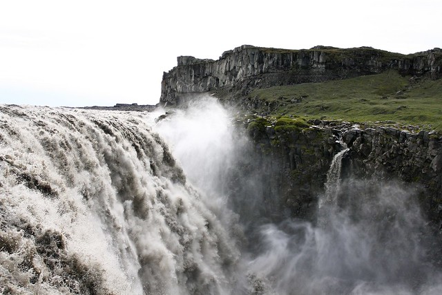
Dettifoss is one of the most powerful waterfalls in all of Europe. Dettifoss is situated on the Jökulsá á Fjöllum river, which flows from the Vatnajökull glacier and collects water from a large area in Northeast Iceland. The falls are 100 metres wide and have a drop of 45 metres (150 ft) down to the Jökulsárgljúfur canyon. It is the largest waterfall in Iceland in terms of volume discharge, having an average water flow of 193 m3/s. Dettifoss can be reached by a route 862 and route 864 (an older gravel road). Make sure to do some research on driving directions to Dettifoss and pay attention to local weather conditions. Route 864 is closed in winter and even route 862 on heavy snow days.
Mývatn
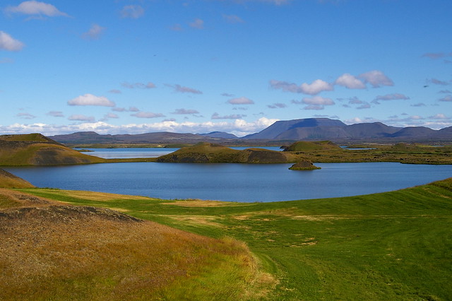
Mývatn offers a unique natural environment. Within a relatively small area you can experience the best that Iceland has to offer. Large open spaces with roads and walkways lead travellers to interesting locations, were volcanic eruptions have played a crucial role in forming the landscape. Whether the plan is to enjoy the landscape, examine unique natural phenomena or take a closer look at the pant and bird life, Mývatn has it all. Furthermore the area offers a variety of services in accommodation, food and entertainment. A large number of travellers visit Mývatn in the summer, but the lake and its surroundings are no less impressive in the wintertime. Check out wikivoyage.org for more tips for things to see in the area.
Goðafoss
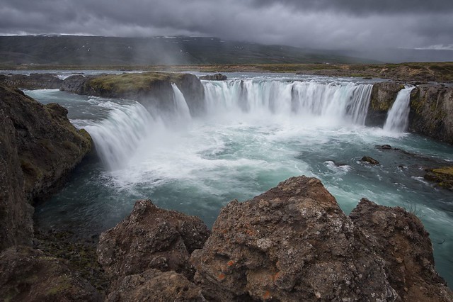
Nicknamed as ‘The Beauty’ in comparison to ‘The Beast’ of Dettifoss, the name Goðafoss could be translated roughly as The Waterfall of The Gods. Goðafoss is an impressive sight any time of year, though in late spring you can catch it while there are still icicles covering its sides and it’s a particularly otherworldly place to visit. There is a small guesthouse and restaurant on site. The falls are located just off the ring road and can be viewed from either side.
Aldeyjarfoss
Aldeyjarfoss is located off the beaten track and might seem out of the way to reach, but when you we see it, it will feel worth the trouble. The basalt columns and the powdery blue colour of the water attest to the glacial origins of the water. Tumbling through a narrow passage into a wide basin, the black basalt columns provide a stark contrast against the thrashing white foam, making it one of Iceland’s photographic gems.
Akureyri
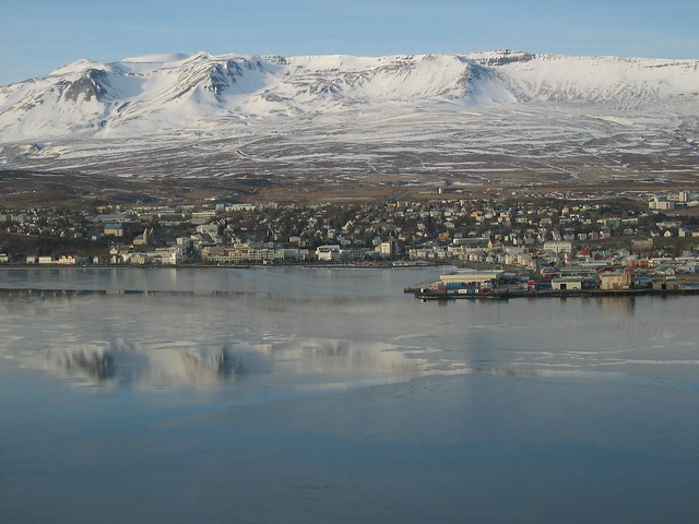
Akureyri sits on the north coast under snow-capped peaks at the head of Iceland’s longest fjord. It’s Iceland’s second biggest urban area, and while you shouldn’t expect a big-city vibe, this easy-going place has more buzz than anywhere outside of Reykjavík. It’s also a great base for exploring the north’s green pastures, fishing villages, mudpots, waterfalls and whale-filled bays. Signs of the earth’s power – glaciers, volcanoes, lava fields and stacks of basalt – are everywhere. Akureyri Backpackers is located in the middle of town and offers great budget accommodation.
Kjarnaskógur
South of Akureyri is Iceland’s most visited forest, Kjarnaskogur. The recreational area is about 600 ha with more than 1 million trees of many species planted within the last 50 years. The area has 7 km of light trails in addition to a vast network of backcountry trails. There is also a 10km long designated mountain bike trail. There are two playgrounds, picnic areas, barbecue facilities and restrooms. The area has a very varied bird life and even a bird watching shelter.
Borgarvirki
Borgarvirki is a 10-15 metre high ridge of columnar rock and a volcanic plug. There is speculation as to whether it was, in ancient times, a district fortress and perhaps even a battleground. From Borgarvirki there is a wide panoramic view over a large part of the region and a viewfinder is in place to help locate some of the important landmarks. There are steps leading up to the top of Borgarvirki. It is hard to walk there as it is very rocky and a lot of rocks have fallen from the fortress but the view from there is awesome and worth the hike.
Kolugljúfur Gorge
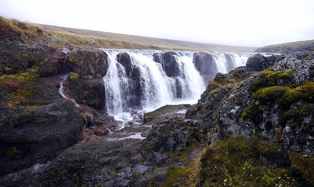
Located about 5km off the Ring Road on route 715 is Kolugil Farm which stands beside the Víðidalsá river. Just below the farm, the waters flow downwards to plunge into the deep, rugged Kolugljúfur gorge. Their journey then sends them cascading over many waterfalls bearing the name Kolufossar Falls. It is a breathtaking sight to drive across the bridge and watch the calm waters of the river suddenly leap and tumble onwards over so many impressive falls.
Map
Transport
There are tours available that will take you through this area of Iceland however a cheaper option is to rent a car and go exploring yourself. It possible to rent a small car for as little as 50€ per day in peak season and 30€ in winter, a rental car is by far the better option. This will also give you greater freedom to visit all the stops in the order that suits you and at the time of day that is most convenient. Perhaps the cheapest car rentals in Iceland are through sadcars.com



Leave a reply